This area is highlighted. Neighboring areas are shown in lighter color. Open the Wasilla homes for sale hub for all 13 area guides, or pick a shape below.
Fishhook links northern Wasilla and Palmer-side roads with the foothills of the Talkeetna Mountains. The residential setting includes wooded land, larger parcels and homes described by their mountain outlook. The position of a house on the land gives each property its own relationship to that wider landscape. Fishhook & Hatcher Pass homes for sale include wooded land, larger parcels and homes described by their mountain outlook. If you want to buy a home in Fishhook & Hatcher Pass, Wasilla, look at the position of the house on the land, not only the road name.
A first visit works best when it includes both the residential streets and the road toward the mountains. Spend time around the homes that interest you, then see how the local route connects with the public recreation destinations above. It is a useful way to understand the difference between the foothill home setting and the larger Hatcher Pass area that draws people out for a day.
roads
Get to know both Fishhook road references
Wasilla-Fishhook Road and Palmer-Fishhook Road organize different approaches through the area. The route toward Wasilla, the route toward Palmer and the highway connection for Anchorage can therefore start quite differently from one residential location to another. Include those everyday directions in a home-search outing.
Alaska State Parks describes the paved Palmer-Fishhook approach as open year-round, with the final mile to Independence Mine closed in winter. The rough Hatcher Pass summit road is a summer-season route, generally open for a short period depending on snow. The Parks and Glenn network supplies the year-round regional travel framework; the mountain road adds a separate seasonal outing.
Getting around from here
Tap a destination to compare the same representative road point used for these estimates. The chooser does not use your location or make a live routing request.
25 min
Wasilla City Hall · 12.4 miles
Route: Representative road point to Wasilla City Hall; no turn-by-turn directions.
No-traffic OSRM estimates from a representative road point, rounded up to five minutes; your driveway, traffic and weather add time.
The Hatcher Pass East Management Area includes the Gold Mint, Archangel and Fishhook trailheads, Government Peak Campground and Independence Mine State Historic Park. Alaska State Parks describes hiking, skiing and other seasonal activities across a large mountain landscape. Choosing a specific destination makes the area much easier to explore than simply aiming for “Hatcher Pass.”
For a first foothill visit, pair the residential roads with the approach to the public destination you expect to use most. That puts the house search and a future recreation routine into the same picture. Current State Parks road, recreation and seasonal-use information is the useful planning companion, especially when the upper landscape is moving between summer and winter conditions.
Swipe the strip, then tap a photo to open it full-screen. These licensed regional images show the wider Mat-Su and Hatcher Pass landscape—not individual neighborhoods, listings or views promised from a home.
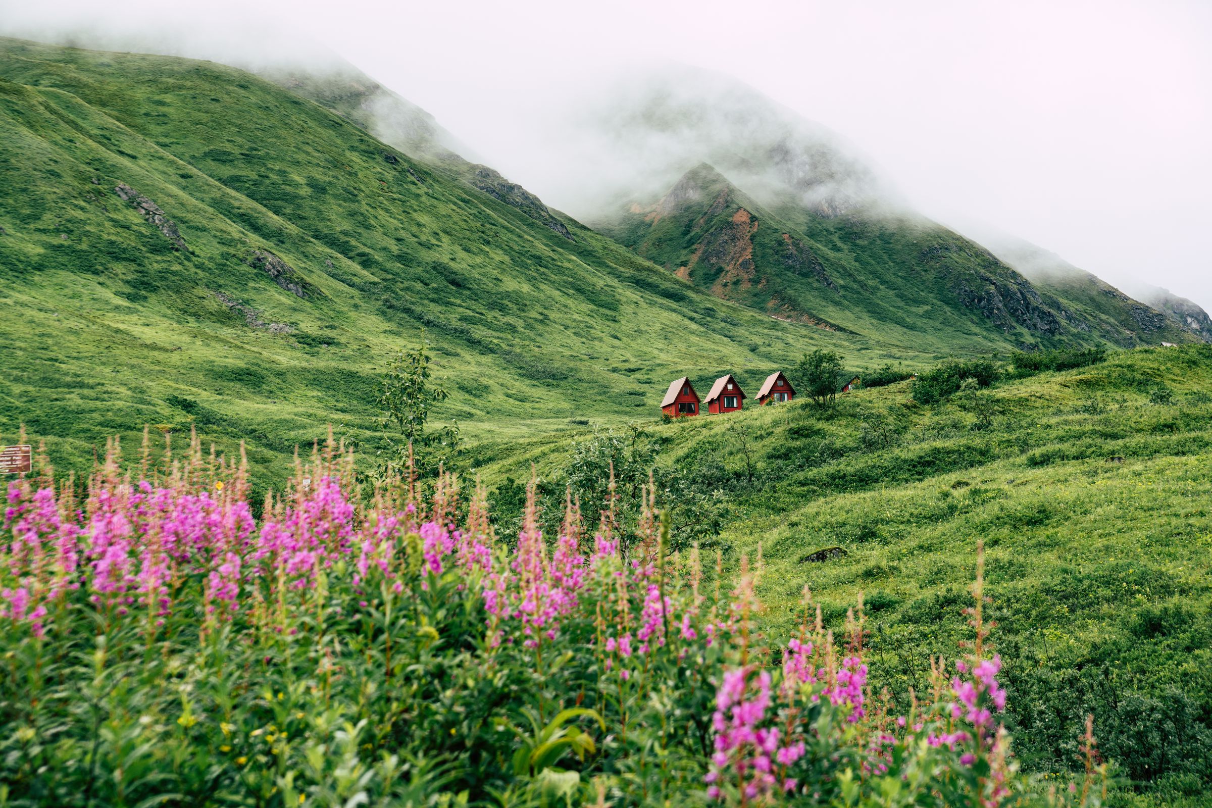
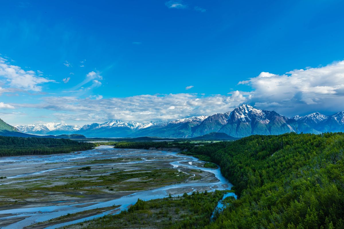
Regional Pioneer Peak and Matanuska River. Photo: iStock.com/Alan Musy - ADM PhotoGraphics.Pioneer Peak above fields near Palmer — regional context. Photo: iStock.com/wibberelvin.Hatcher Pass recreation-area cabins, a drive from Wasilla. Photo: iStock.com/Melissa Kopka.
homes
Topography gives each property its own arrangement
The foothill search can include detached houses, larger wooded lots and homes with a mountain outlook. The land’s shape often becomes an important part of the layout: the position of the driveway, the level used for the main entrance and the relationship between the house, garage and yard.
During a showing, spend time moving through those connections. A house set on a slope can use levels very differently from one on a flatter clearing. The view from the main living space is one part of the experience; the entry, parking and outdoor spaces complete it. Comparing both sides helps turn a striking mountain-area photograph into a practical picture of the home.
utilities
Water, wastewater, power and heat
Everyday services connect this area with the wider Mat-Su network. Matanuska Electric Association supplies regional power, and ENSTAR provides natural gas on served streets. Private wells and on-site wastewater systems are common outside municipal utility areas, alongside other development-specific arrangements. City utility service areas and municipal boundaries are separate layers of the map.
Mining routes connect the foothills with early Wasilla
Alaska State Parks describes Hatcher Pass as a landscape with a long history of gold prospecting and mining, including Independence Mine. The City’s history links early Wasilla with the supply route to the Willow Creek mining district. Together, those accounts connect the modern mountain outing with the region’s earlier transport story.
That background adds another layer to a drive through the foothills. The residential roads sit below a recreation landscape that also contains historic mining resources and continuing land interests. Independence Mine provides a named public historic destination, while the Fishhook council and Borough planning records give the civic context for the residential area today.
The foothill view changes with the season when moving to Fishhook & Hatcher Pass
Seasonal planning notes with illustrative regional photos—not verified summer/winter scenes or a matched photo pair. The full local notes remain below.
Summer gives you time to explore the residential roads and a mountain destination on the same trip.
Photo: iStock.com/Alan Musy - ADM PhotoGraphics
Summer gives you time to explore the residential roads and a mountain destination on the same trip. Fall changes the wooded lots and the upper landscape. Winter brings a different rhythm, with the home’s driveway, garage and entrances more prominent in everyday use and mountain recreation following its own seasonal pattern.
Spring breakup returns attention to the land around the house, the driveway edges and the paths of snowmelt. Seeing a property in a second season helps you understand how its topography works with the buildings. It also adds context to the view: the trees, snow and upper-mountain conditions can change the outlook considerably through the year.
daily life
Build a foothill comparison around real destinations
Start with the homes on your shortlist, then drive the practical connection toward Wasilla or Palmer. Add the approach to a public recreation destination if time allows. This puts the residential setting, daily route and Hatcher Pass outing into one understandable map.
North Lakes and Tanaina provide useful comparisons lower in the northern road network. Gateway adds the Trunk Road side of the Wasilla–Palmer connection. A broader map-based search can also include Palmer-labeled listings relevant to the foothills. Seeing the adjoining areas helps decide how strongly you want the mountain approach to shape the rest of your home search.
Before you buy a home in Fishhook & Hatcher Pass, Wasilla
Water & wastewater:
Review well yield, water tests and septic records, or confirm the property’s City/STEP or community-system service.
Power & heat:
Check gas availability, heating records and MEA capacity for any shop or addition.
Roads:
Establish year-round access and who maintains and plows the street and driveway.
Lot & covenants:
Read the survey, easements, shared-access rights and subdivision rules for your plans.
Permits & drainage:
Review proposed uses, waterbody/floodplain requirements and spring drainage with the relevant agencies.
Wasilla-Fishhook Road and Palmer-Fishhook Road are separate references that help organize the wider residential foothill area and its routes toward the two cities.
What are useful Hatcher Pass destinations?
Alaska State Parks lists Gold Mint, Archangel and Fishhook trailheads, Government Peak Campground and Independence Mine State Historic Park within the east management area.
When is the summit road open?
The rough route over Hatcher Pass is seasonal, generally opening during a short summer window depending on snow. The paved Palmer-Fishhook approach has a different year-round role, with the final mine mile closed in winter.
Next steps
Start with current listings, then narrow the map.
Start with the wider Wasilla listings, then explore the places that fit your plans. If you already live here and want to sell a home in Fishhook & Hatcher Pass, start with how the property sits in the foothills.
On the results page, tap Save Search to save it to your dashboard and set up email alerts. Sign in or create your account if prompted, then choose your alert settings.
The listing content relating to real estate for sale on this web site comes in part from the IDX Program of Alaska Multiple Listing Service, Inc. (AK MLS). Real estate listings held by brokerage firms other than Keller Williams Realty Alaska Group are marked with either the listing brokerage’s logo or the AK MLS logo and information about them includes the name of the listing brokerage. All information is deemed reliable but is not guaranteed and should be independently verified for accuracy. Listing last updated: